

VIO GPS-Free Navigation
No need to pre-load maps,
Visual navigation module for Drones in GPS-denied environment
Retail priced under $399. Available for bulk purchase
Talk to sales for bulk quotation and product documents
Retail purchases available at our online shop

Subscribe to Email for discounted bulk Quote & Tech Docs
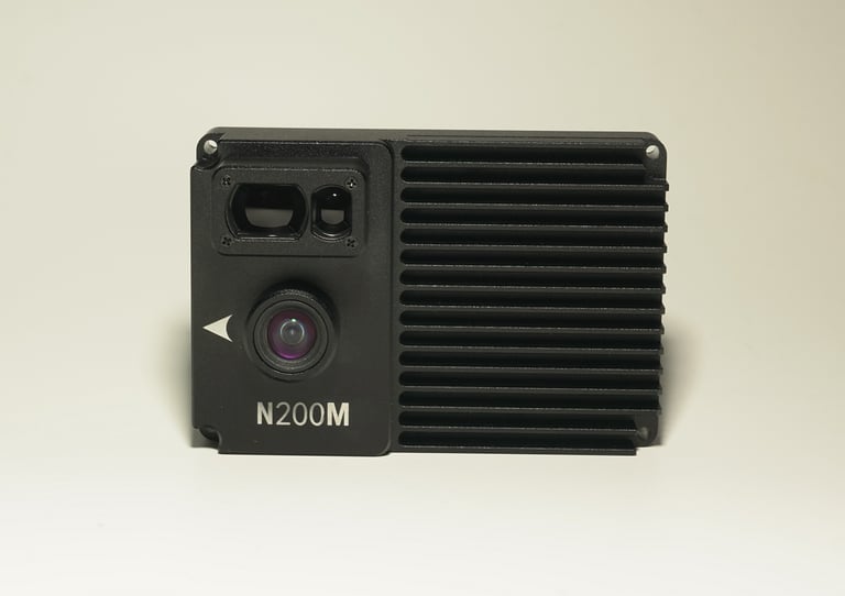
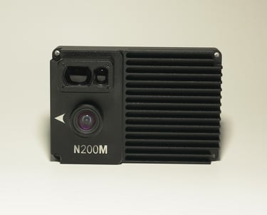
N200M VIO Navigation Module
Precise Navigation
Navigation Accuracy: ≤5%
Enables precise positioning by optimizing visual sensor for dynamic scenes and eliminating motion blur from high-speed movement
Easy to deploy
Operates without dependency on pre-existing geospatial data
Adheres to MAVLink Standard Protocol
No development required—just simple configuration.
Ignore to GPS jamming
Fuses visual/IMU data for GPS-denied waypoint navigation
Compatibility
Compatible with a variety of drone models
Supports PX4&APM flight controllers(more platforms coming)
Executes pre-mapped routes under active EM interference
Immune to GPS interference. Capable of executing precise route flights and accurate takeoff/landing positioning even in the absence of GPS signals.
How It works & Accuracy Validation
This product is an AI visual navigation device specifically designed for drone positioning and GPS free navigation under GPS-denied conditions.
It integrates an onboard computer with a high-performance CPU and NPU, a 1080p camera, and a laser ranging sensor.
It enables precise positioning by optimizing the visual sensor for dynamic scenes, which eliminates motion blur from high-speed movement and ensures stable ground image recognition during drone flight, supported by robust chip computing power.
No pre-installed satellite maps are required: The module uses AI to analyze visual frame changes and fuses IMU, compass, and other attitude data from the flight controller to calculate the current relative position, enabling drone global positioning. Additionally, the laser rangefinder continuously monitors ground height changes, ensuring adaptability to terrain variations.
Subscribe to Email for discounted bulk Quote & Tech Docs
Navigate in GPS Denied Environment
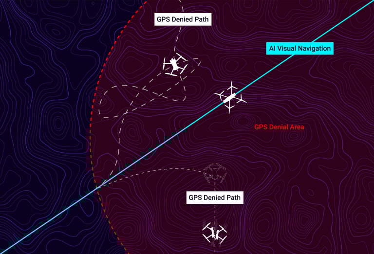
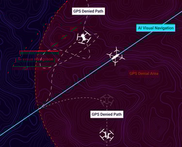
VIO GPS Free navigation does not rely on any radio signals and offers advantages such as:
interference-resistant
spoofing-resistant
undetectable
It enables aircraft to perform high-precision navigation flights in GPS-denied areas, execute pre-set flight paths, or return to the departure point.
Talk to sales for bulk quotation and product documents
The product is now available for sale